Strater

Strater displays your raw data as borehole and well logs, maps and cross sections. Strater's point-and-click user interface visualizes your subsurface data and creates professional reports.

Languages supported: English

8.6/10 (Expert Score) ★★★★★
Product is rated as #15 in category Geology and Seismic Software
Ease of use
Support
Ease of Setup

Images

Check Software Images

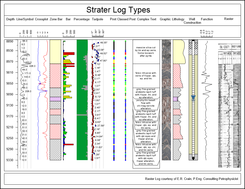
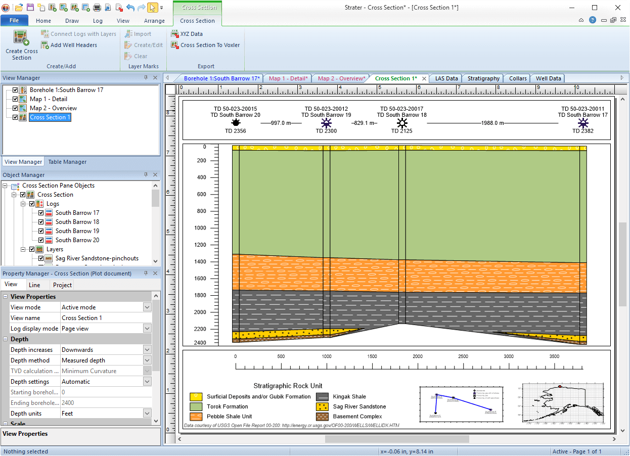
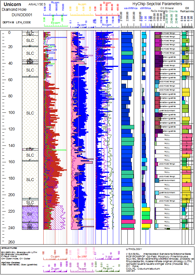
StraterВ® is an intuitive subsurface visualization program designed to display a wide variety of well log, borehole, and cross section data. Strater converts geotechnical, geophysical, environmental, and mining data from a wide variety of file formats into 15 different log types, borehole models, and cross section views. Strater offers unsurpassed flexibility in design and layout of the log and cross section displays. Virtually every aspect of Strater’s plot is customizable, allowing users to quickly and easily create publication-quality reports.

Strater is used extensively by geoscientists and engineers across the globe.

Strater
Strater

Show more categories

Customer Reviews

Strater Reviews

Gustavo G.

Advanced user of Strater
★★★★★
Great geological software!

What do you like best?

The simplicity and clarity of converting geotechnical, environmental and mining data into different types of logos, models, etc.

What do you dislike?

Some tools are confusing at first but it took some time to get the hang of it.

What problems are you solving with the product? What benefits have you realized?

Generate borehole models for my environmental class project.

Review source: G2.com

Leave a reply

Your total score

B2B Software Guide