
FME is the data integration software with the best support for spatial data – no coding required. Use FME to connect hundreds of applications, transform data structure and content, and automate tasks.

FME
Images
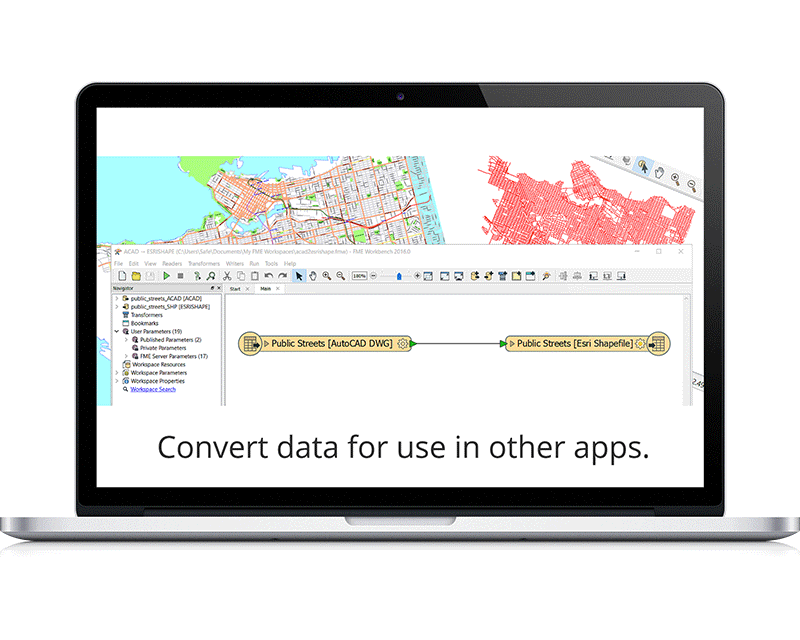


FME is the data integration software with the best support for spatial data – no coding required. Use FME to connect hundreds of applications, transform data structure and content, and automate tasks.
Customer Reviews
Elena G.
Advanced user of FMEFME is an easy to use tool to create ETL(extract-transform-load) workflows for spatial and non-spatial data. It handles enormous number of spatial and non-spatial data formats, so you could transform almost anything-to-anything. Most common formats including shapefiles, ESRI file geodatabases, spatial data in various relational databases. You even can automatically post tweets based on your data. Besides the format conversion, other important feature is data transformation capabilities, so you can perform complex spatial transformations, like buffering, subsetting, spatial queries, joins, attribute calculations - almost anything that you can do using the conventional GIS, like ArcGIS or QGIS but in an automated way.
Product is expensive, no way to run the FME workflows for free.
Various ETL projects, such as tiling scanned raster maps, and converting the data between various formats.


